
Kashyem Kaman Kalimpong Teesta Rangpo confluence view — Teesta-Rangpo confluence below and Kanchenjunga above — plus Cinchona heritage trails and cedar forest homestays at ₹1,250/day.
There is a specific kind of view that requires exactly the right elevation — too high and the cloud covers everything, too low and the angle is wrong. Kashyem Kaman sits at precisely the right elevation.
At 4,000 to 4,265 feet on a prominent ridge in the Pedong Block of Kalimpong district, this quiet hamlet has discovered, somewhat by accident, that its intermediate altitude between the fog-prone high ridges and the humidity-trapped valley floors gives it something rare: simultaneously clear sightlines to both the Teesta-Rangpo river confluence in the valley below and the Kanchenjunga massif on the northern horizon above.
Two completely different geographical scales — a river junction and the world’s third-highest mountain — visible from the same vantage point.
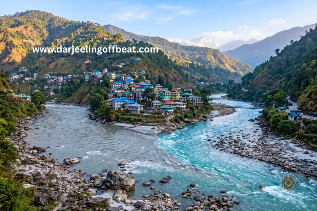
The confluence below is where the Rangpo River, flowing westward out of East Sikkim, meets the southward-rushing Teesta River at the political boundary separating West Bengal from Sikkim. The turquoise Teesta and the silt-laden Rangpo briefly retain their distinct characters at the meeting point before merging into a unified flow that continues toward the plains.
The view from Kashyem Kaman catches this junction with the specific optical clarity that the ridge’s intermediate elevation produces — not the compressed, narrow angle of a valley viewpoint, not the cloud-softened distance of a high ridge, but the precise intermediate position where both the confluence and the mountain are sharp and readable simultaneously.
The settlement is approximately 20 to 24 kilometres from Kalimpong town, 12 kilometres from Rangpo (the primary gateway into Sikkim), and 89 kilometres from Siliguri. Its immediate neighbours in the offbeat circuit — Sillery Gaon, Icche Gaon, and Munsong — give it circuit connectivity without requiring it to be famous in its own right to be worth visiting.
It isn’t famous. It is worth visiting.
The Cedar-Pine-Oak Forest — Kashyem Kaman Kalimpong Teesta Rangpo confluence view
The temperate vegetation of Kashyem Kaman reflects its ridge position in the Pedong Block’s hill system — the specific combination of cedar (Cedrus deodara), Himalayan pine (Pinus roxburghii — locally called Dhupi), and oak (Quercus species) that produces the forest character visitors encounter on arrival.
The deodar cedar of the upper slopes has the distinctive horizontal branching and resinous fragrance that separates it from the pine.
Walking through cedar forest at Kashyem Kaman in the morning — when the cold air concentrates the resin smell and the low light produces the long shadows between the columnar trunks — is an atmospherically specific experience that the pine-dominated forests of Darjeeling town or the broadleaf-dominated forests of Neora Valley don’t replicate.
The Dhupi pine (Chir pine) covers the more exposed ridge sections and south-facing slopes. Its association with the Cinchona cultivation that historically defined the ridge’s economy is specific: the British plantation managers found that the partial shade of a pine understorey, rather than full canopy cover, produced the drainage and humidity conditions that Cinchona species preferred.
The oak forest fills the sheltered north-facing aspects and the deeper valley-facing slopes — the highest biodiversity section of the forest, where the epiphytic community thrives in the greater moisture retention of the broadleaf canopy.
The forest’s temperate microclimate — moderate summers, clear cold winters — is the product of this combined vegetative cover maintaining a stable temperature envelope through the year.
Interspersed through all three forest types, and the reason the Kashyem name appears in the broader Munsong Cinchona Plantation’s divisional structure, is the Cinchona — the remaining trees from the colonial agricultural project that the landscape has not yet fully absorbed back into its native character.
The Cinchona Story — Colonial Botanical History on the Ridge
Kashyem Kaman‘s origin as a settlement is inseparable from the British colonial project to secure a domestic quinine supply within the Indian Empire. The story deserves telling properly because it makes the forest walk a historical encounter rather than simply a botanical one.
In the mid-nineteenth century, malaria was the single largest cause of mortality and morbidity across tropical British India. The bark of the South American Cinchona tree was the only effective source of quinine — the active compound that treated the disease. British India’s dependence on South American Cinchona exports was a strategic vulnerability that the colonial administration addressed through systematic plantation development in the Eastern Himalayan hills.
The Munsong Cinchona Plantation, established in 1901 as the second-largest station under the Directorate of Cinchona and Other Medicinal Plants, used the Kashyem Kaman division as one of its operational sub-units.
The ridge’s specific combination of elevation, rainfall, and soil drainage matched the Andean highland conditions that Cinchona species require. Plantation families settled the ridge to work the cultivation, and Kashyem Kaman became a working agricultural settlement built around a colonial pharmaceutical project.
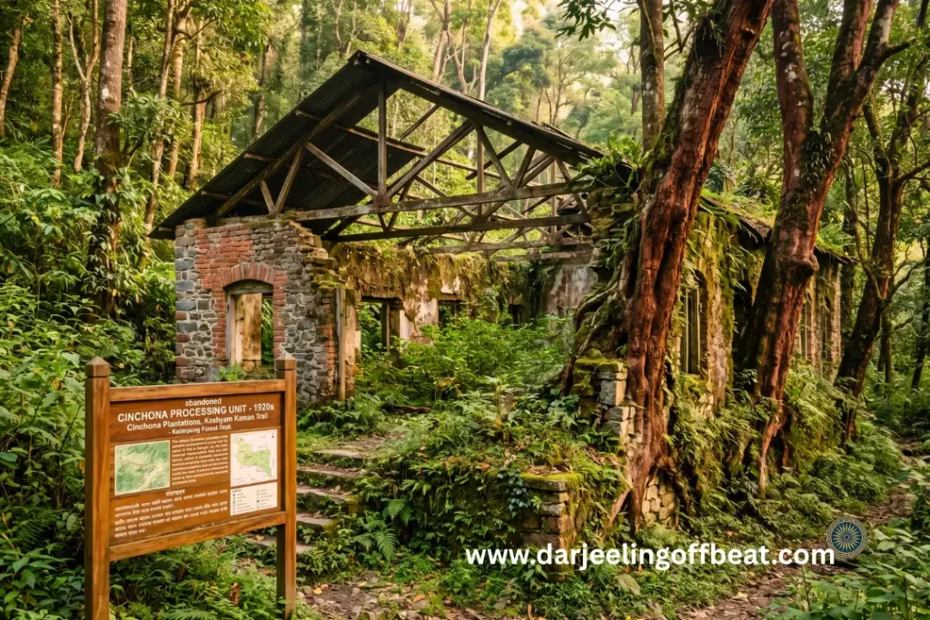
The abandoned Cinchona processing unit accessible via a local trekking trail from the village is the most direct physical connection to this history. This is where raw bark harvested from the surrounding Cinchona trees was historically dried, crushed, and prepared for chemical refining into quinine.
The structure’s abandonment reflects the mid-to-late twentieth-century collapse of natural quinine demand following the development of synthetic antimalarial pharmaceuticals — the economic disruption that forced the plantation families to reinvent their livelihoods through subsistence agriculture, organic horticulture, and ultimately the homestay tourism that defines the contemporary Kashyem Kaman economy.
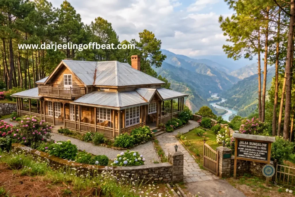
The Jalsa Bungalow — approximately 10 kilometres away in the Upper Munsong division, constructed between the early 1920s and 1930 to house British plantation directors — is the heritage landmark of this colonial system.
At 5,000 feet amid pine groves, with sweeping views across twelve major bends of the Teesta River, the bungalow remains under the custody of the Directorate of Cinchona and Other Medicinal Plants (DCOMP).
It is both a living administrative property and a historical artefact — the physical record of the colonial pharmaceutical economy that built this landscape.
Walking the trail from Kashyem Kaman to the abandoned processing unit with this history in mind converts a forest walk into an industrial archaeology experience: you are walking through the infrastructure of a 19th-century
pharmaceutical supply chain that operated at one end of a global commodity system connecting South American forests, Indian hill plantations, and the blood chemistry of millions of people across tropical Asia.
The Viewpoint Trek — Through Sillery Pine Forest to the Confluence
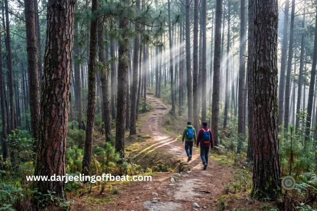
The primary viewing experience at Kashyem Kaman requires a short uphill trek through the adjacent Sillery pine forest — a walk of 20 to 40 minutes depending on pace — that opens onto a ridge-top clearing providing the dual-aspect panorama that defines the destination.
The trail through the Sillery canopy is itself the experiential substance of the trek rather than merely the means of reaching the viewpoint. The pine forest on the approach — the dappled light, the fragrance, the specific quiet of a conifer canopy on a cold morning — produces the atmospheric preparation for the view’s arrival.
At the ridge-top clearing, the panorama assembles in two directions simultaneously:
Southward and westward: The silt-laden Rangpo River merging into the turquoise Teesta in the deep valley below — the political boundary of West Bengal and Sikkim made visible as a river junction. The specific colour contrast between the two streams at the confluence point is visible on clear days, the different sediment loads of the two rivers maintaining brief optical distinction before mixing.
Northward and northwestward: Mount Kanchenjunga and the surrounding massif rising above the Sikkimese and North Bengali mountain ranges — the same view available from multiple Kalimpong hills destinations, but from Kashyem Kaman’s intermediate elevation with the specific atmospheric clarity that sits between the high-ridge fog zone above and the valley humidity zone below.
The autumn season (September to November) is the primary photography window: the post-monsoon atmospheric scrubbing leaves the sky exceptionally clear, yielding the crisp, shadow-rich visibility that makes both the confluence detail and the mountain massif readable in the same frame.
The Heritage Sites — Church, Himali Park, and Burmaik Dham
Kashyem Village Church serves as the historic architectural and social focal point for the local Christian community — a reminder that the missionary influence that built institutions across the Darjeeling-Kalimpong hills also reached the plantation settlements along the Pedong ridge.
Himali Park has been developed around a natural mountain stream and waterfall within the village — a landscaped space integrated into the native forest rather than imposed upon it. The stream character and the waterfall provide the specific water-sound landscape that the dry ridge environment above the Teesta valley creates demand for.
Burmaik Mahadev Dham — approximately 4 to 5 kilometres from Kashyem Kaman — is a secluded Hindu shrine surrounded by old-growth forest. The specific forest character of the shrine approach, where the native trees
have been allowed to grow to their full size because the sacred space discourages extraction, produces the undisturbed forest atmosphere that Cinchona-replaced plantation forest elsewhere in the ridge cannot provide.
The Broader Circuit — What Kashyem Kaman Kalimpong Teesta Rangpo Confluence View Connects To
Kashyem Kaman Kalimpong Teesta Rangpo confluence view’s position on the ridge network between Kalimpong and the Sikkim border makes it a natural node in a circuit that covers multiple distinct landscape types within a compact geographical area.
Sillery Gaon — accessible by short road transfer, the pine-clad village with the established Kanchenjunga viewpoint and forest trail infrastructure.
Icche Gaon — the Wish Village of the eastern Kalimpong circuit, with the Daragaon forest trail connection to the cloud-sea Kanchenjunga view.
Ramdhura — the high-altitude ridge viewpoint with complementary forest trekking routes.
Simanadara (Simana Dara) — the Indo-Nepal border viewpoint on the Darjeeling-Mirik highway offering the high-ridge perspective across the border.
Reshikhola — the river village along the Rishi River, providing the low-altitude riverine complement to Kashyem Kaman’s ridge character.
Silence Valley — the quiet meadow landscape accessible from the Pedong corridor.
Damsang Fort ruins, Pedong — the 300-year-old Bhutanese defensive structure that is the most historically significant heritage site in the immediate circuit.
Kalimpong town — Delo Park, Durpin Dara Monastery, Pine View Nursery, Kalimpong Science Centre — all accessible as half-day excursions.
Rangpo (12 km) — the Sikkim gateway for those extending the circuit into East Sikkim’s Silk Route destinations.
Getting to Kashyem Kaman
From Kalimpong town: 20 to 24 kilometres — roughly 1 hour via the Pedong-Algarah branch road network.
From Rangpo (Sikkim border): 12 kilometres uphill — the most direct approach from Sikkim, making Kashyem Kaman a natural first West Bengal stop for Sikkim-side travellers.
From NJP (New Jalpaiguri): 89 to 95 kilometres — roughly 3.5 to 4.5 hours via NH10 through the Teesta Bazaar corridor and the Kalimpong ascent.
From Bagdogra Airport: 100 to 102 kilometres — similar road time via the same NH10 approach.
From Siliguri: Approximately 89 kilometres.
From Gangtok: Via Rangpo — 12 kilometres from the border town, making the Kashyem Kaman ridge accessible within 2.5 to 3 hours of Gangtok.
The approach via NH10 along the Teesta River gorge is itself scenically significant — the river visible below as the same watercourse that Kashyem Kaman looks down on from above, the relationship between the road-level river and the ridge viewpoint made legible during the ascent.
Staying at Kashyem Kaman — The Homestay Network
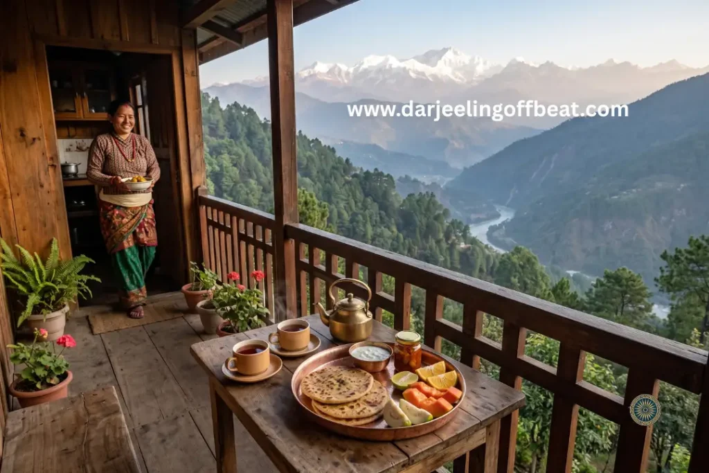
Accommodation at Kashyem Kaman is exclusively family-run homestays — no commercial hotel development, a deliberate preservation of the village’s quiet character and low footprint.
Established properties include Dimmaliz Homestay, VB Homestay, Sohag Homestay, Megla Homestay, and Pratima’s Cloud House — each with typical inventories of 3 to 6 guest rooms, keeping the scale genuinely intimate.
Standard configurations include:
- Attached Western-style bathrooms with geyser-fed hot water
- Private balconies with valley or snow-peak orientation
- Sitting areas and open dining terraces
- Full-board meal packages featuring home-cooked Nepali and North Indian cuisine from locally sourced organic ingredients
Tariff: Approximately ₹1,250 per person per day — full board (room plus all meals) included.
Local hosts including Mr Khawas and Pankaj provide the personalised hosting that family-run properties produce when the host’s primary identity is community member rather than hospitality professional.
The Seasonal Calendar — When Each Quality of Experience Is Available
Spring (March to May): Temperatures 15°C to 25°C. The surrounding forest canopy flowers with native orchids and rhododendrons. Optimal conditions for trekking, birdwatching, and outdoor sightseeing. The Cinchona processing unit trail is at its most botanically rich.
Monsoon (June to August): Heavy rainfall revitalises streams, waterfalls, and agricultural terracing. Himali Park’s waterfall is at maximum volume. NH10 can be affected by landslips. Visibility of the confluence and mountain view is reduced. The forest is at maximum green intensity.
Autumn (September to November) — Prime Season: Post-monsoon atmospheric scrubbing produces exceptional clarity. The confluence view and Kanchenjunga panorama are at their sharpest. The best window for mountain photography and confluence observation. Comfortable temperatures for the Sillery forest trek.
Winter (December to February): Temperatures 5°C to 12°C. Cold mornings and evenings but consistently clear, sunny days with stable mountain views. The confluence view in the cold, clear winter air is the sharpest of the year. The cedar forest in winter light has the specific quality of low-angle sun through tall conifer trunks.
The Conservation Priorities — What Needs to Be Protected
The specific qualities that make Kashyem Kaman worth visiting — the forest atmosphere, the unobstructed confluence and mountain view, the quiet character — depend on specific physical decisions being made consistently over time.
The abandoned Cinchona processing unit represents the most immediate heritage conservation opportunity: development as an open-air historical educational station would activate the site without heavy capital investment and integrate the colonial botanical history into the visitor experience in a form that adds intellectual depth to the forest walk.
Low-density building guidelines — capping heights at two stories and encouraging traditional timber and stone construction — are the physical protection mechanism for the confluence view corridor. Tall commercial structures on the ridge skyline would degrade the specific visual quality that the viewpoint depends on.
Rainwater harvesting and solar water heating support for homestay operators would reduce seasonal pressure on natural mountain springs and mitigate winter grid interruptions — the two resource vulnerabilities most likely to affect the visitor experience during peak seasons.
Light trail infrastructure on the Sillery pine forest trek — wooden directional signage, designated waste collection points, simple timber handrails on steep sections — would improve visitor safety without the ecological impact of paved surfaces on a forest slope.
Elevation: 4,000–4,265 ft (1,219–1,300 m)
Block: Pedong Block, Kalimpong District, West Bengal
From Kalimpong: 20–24 km | From Rangpo: 12 km | From NJP: 89–95 km | From Bagdogra: 100–102 km
Forest character: Cedar (Deodar), Dhupi Pine, Oak, Cinchona
Heritage: Abandoned Cinchona processing unit, Jalsa Bungalow (c.1920–30, DCOMP), Munsong Cinchona Plantation
Key viewpoint: Teesta-Rangpo confluence (below) + Kanchenjunga (above) — simultaneous dual-aspect panorama
Homestays: Dimmaliz, VB, Sohag, Megla, Pratima’s Cloud House | ₹1,250/person/day full board
Local heritage sites: Kashyem Village Church, Himali Park, Burmaik Mahadev Dham
Circuit: Sillery Gaon, Icche Gaon, Ramdhura, Reshikhola, Damsang Fort/Pedong, Kalimpong town, Rangpo
Best seasons: September–November (prime) and March–May
Don’t miss: Confluence viewpoint trek through Sillery pine forest, abandoned Cinchona processing unit, Jalsa Bungalow excursion, Burmaik Mahadev Dham forest walk, Damsang Fort day trip
- Kashyem Kaman Kalimpong Teesta Rangpo Confluence View 2026: The Cedar Ridge
 Kashyem Kaman Kalimpong Teesta Rangpo confluence view — Teesta-Rangpo confluence below and Kanchenjunga above — plus Cinchona heritage trails and cedar forest homestays at ₹1,250/day. There is a specific kind of view that requires exactly the right elevation — too high and the cloud covers everything, too low and the angle is wrong. Kashyem Kaman …
 - Kalijhora Homestay & Teesta Travel Guide: How a Picnic Spot Turned Into North Bengal’s Quietest Adventure Hub
 Kalijhora homestay guide: where to stay near the Teesta, rafting routes & prices, Panboo ridge views, and everything to plan your North Bengal trip If you’ve driven up NH10 from Siliguri toward Kalimpong or Darjeeling, you’ve passed through Kalijhora without necessarily noticing it. That’s kind of the point. It sits about 28 kilometres north of …
 - Goiri Gaon, Kalimpong: The Village the Forest Kept Secret — Now With the Full Story
 Goiri Gaon Kalimpong Neora Valley offbeat — red panda corridor, Maria Busty 1891 church, Pedong Silk Route ruins, and homestay-only model. Complete offbeat guide inside. There are places in the Eastern Himalayas that exist in a kind of geographical grace — tucked far enough from the main roads that the noise of modern hill tourism …
 - Gitkolbong Village Kalimpong: The Village That Climbs From River to Ridge
 Gitkolbong village Kalimpong near Lava, with tea plantations, the Gitkhola river, and a ridge trail to Gitkolbong Top with Kanchenjunga views. Complete offbeat travel guide inside. Some places reveal themselves slowly. You arrive, and the first impression is modest — a quiet mountain village, some terraced farmland, a stream you can hear before you see …
 - Daragaon Kalimpong Kanchenjunga View Where the Clouds Stay Below You
 Daragaon Kalimpong Kanchenjunga view— offers a rare sea-of-clouds sunrise view with the world’s third-highest peak floating above the Teesta valley. Complete travel guide inside. There’s a moment that happens at Daragaon — usually around six in the morning, usually in October or November — that people struggle to describe accurately afterwards. You’re standing at the …
 - Dalapchand Silk Route Kalimpong: Where West Bengal Meets Sikkim
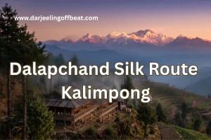 Some destinations, like Dalapchand Silk Route Kalimpong, exist because someone put them on a map, and others exist because the landscape demanded them. Dalapchand is the second kind. Sitting right on the border zone between Kalimpong district in West Bengal and Pakyong district in East Sikkim, this quiet mountain hamlet occupies a genuinely rare position. …
 - Chuikhim birding Kalimpong: That Sits Between Two Worlds
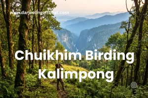 There’s a particular kind of traveller who plans a trip around a bird. Who wakes before the alarm, walks quietly into the forest before dawn, and stands absolutely still for twenty minutes because something small and extraordinary might appear in the canopy above. If you know this feeling — or suspect you might — then …
 - Chisang Village Kalimpong: Where India Ends and Bhutan Begins
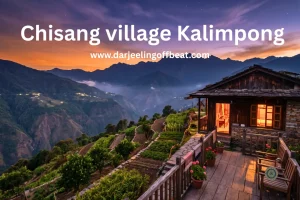 There’s something quietly extraordinary about standing at the edge of a country and not at an airport or a formal border crossing, but on a hillside at dusk, looking across a valley into another nation’s lights. No fence in sight, no checkpoint, just a ridge and a silence and the slow understanding that the world …
 - Bidyang Village, Kalimpong: A Riverside Escape You Didn’t Know You Needed
 Some places earn their reputation through grandeur — towering peaks, famous monasteries, names that appear on every travel list. And then there are places like Bidyang Kalimpong, which earn theirs more quietly. The sound of a river running over stones. The smell of cardamom on a warm afternoon. A valley so tucked away from the …






North Bengal's offbeat magic is my muse. I find adventure in whispering waterfalls, vibrant village life, and breathtaking Himalayan vistas. Join me as I delve deeper, seeking stories and experiences beyond the mainstream, from Darjeeling's tea havens to the unexplored corners of this incredible region