
Goiri Gaon Kalimpong Neora Valley offbeat — red panda corridor, Maria Busty 1891 church, Pedong Silk Route ruins, and homestay-only model. Complete offbeat guide inside.
There are places in the Eastern Himalayas that exist in a kind of geographical grace — tucked far enough from the main roads that the noise of modern hill tourism simply doesn’t reach them, close enough to something extraordinary that the effort of getting there makes immediate sense. Goiri Gaon is one of those villages.
Sitting on the western edge of Neora Valley National Park in Kalimpong district, this quiet hamlet occupies a position that is ecologically rare and practically undervisited. The national park beside it — established in 1986, covering 88 square kilometres, one of the most ecologically intact forest ecosystems in Eastern India — is a wilderness that harbours red pandas, clouded leopards, and a bird list that serious ornithologists travel from across the country to attempt. Goiri Gaon sits right at the edge of all that, close enough that the forest begins where the last homestead ends, far enough from the major tourist corridors that the village has retained a character that most places in the region surrendered some years ago.
A hundred kilometres from Siliguri. Adjacent to Neora Valley. Quiet in a way that is structural, not circumstantial — built into the geography of the place by the dense forest canopy that absorbs ground-level sound vibrations, the bamboo thickets and rhododendron groves that filter wind turbulence, and the physical distance from arterial highways that keeps the vehicular noise of the modern hill circuit from reaching the village at all.
What the visitor hears at Goiri Gaon is what was always there before the roads arrived: avian calls, rustling foliage, mountain streams.
The Administrative Geography — Maria Busty and the Village Network
Goiri Gaon falls under the Samthar Gram Panchayat in Kalimpong district, functioning as a recognised sub-centre within the wider Maria Busty regional network. Its neighbours in that network — Soureni, Benda, Gerok, Chansing, Lingsey, Duka, and Ladam — form a constellation of small settlements across the same mid-altitude zone, each with its own character but sharing the same fundamental quality: distance from the arterial highway corridors that carry most of the region’s tourist traffic.
That distance is the defining feature of Goiri Gaon’s atmosphere. The montane topography surrounding the village acts as a natural sound barrier, absorbing and deflecting the ambient noise that defines most hill town environments. The population within the Samthar Gram Panchayat and Maria Busty parish network displays notably high literacy rates, with many residents employed in regional education and public service — a community that has made deliberate choices about how it engages with tourism rather than simply responding to whatever economic pressure arrived first.
The most significant of those choices: no commercial hotel development. Accommodation at Goiri Gaon is provided exclusively through a community-based homestay system managed by local families. This is not a policy imposed from outside — it is the community’s own decision to keep its physical scale aligned with the ecological carrying capacity of the village, and to ensure that tourism revenue flows directly into the households that host it rather than through external operators.
The Maria Busty Parish — A 19th-Century Cultural Landmark
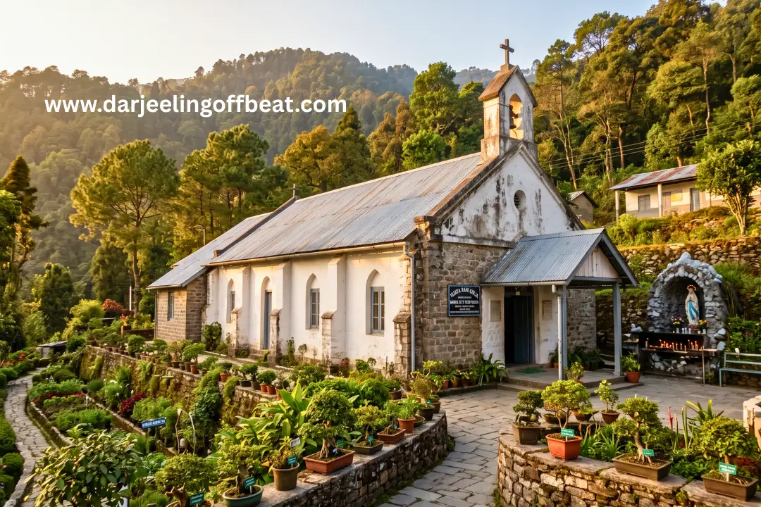
Hidden within the broader Goiri Gaon Kalimpong Neora Valley offbeat circuit is a cultural site that most visitors to the Kalimpong hills have never heard of and that rewards those who find it: the historic Maria Busty Parish, approximately two hours from Kalimpong town via Pedong.
The parish centres on the Vijaya Rani Girja — a church founded in 1891 by Rev. Fr. M. Hervagault of the Foreign Missions of Paris. This is colonial-era missionary architecture in the Eastern Himalayan hills, carrying the specific historical weight of a French Catholic presence in a region simultaneously shaped by British administration, Bhutanese political history, Lepcha indigenous tradition, and Tibetan Buddhist culture. The layering of these influences on a single ridge is one of the more unexpected cultural encounters available in the Kalimpong hills circuit.
The site features a historical Grotto — a small sacred structure in the tradition of European Catholic shrines, translated to a Himalayan hillside setting — and a garden of Himalayan medicinal plants and bonsai cultivated by local educators. This medicinal plant collection is a specific botanical attraction: the curation of regional medicinal flora alongside the traditional practice of bonsai reflects the hybrid knowledge systems that communities at cultural crossroads develop over generations.
For travellers interested in the colonial and missionary heritage that has left physical traces across the Darjeeling-Kalimpong hills — the British cantonment bungalows, the residential schools, the churches and parish buildings — the Maria Busty Parish is a genuine and largely undiscovered addition to the circuit.
Pedong and the Silk Route Heritage
Pedong, 21 kilometres from Kalimpong along the ancient Silk Route that once connected Lhasa to India via the Jelep La Pass, provides the historical depth that the Goiri Gaon circuit benefits from on its cultural dimension.
The Silk Route significance of Pedong is not merely historical. The physical road that the trade route followed — the same road that connected Bengal’s commercial economy to Tibet’s highland economy for centuries — still runs through this corridor, and the landscape bears the marks of that long connectivity: the multi-ethnic communities, the hybrid architectural forms, the cultural convergence of Bhutanese, Sikkimese, Lepcha, and Indian hill influences that characterise every settlement along the route.
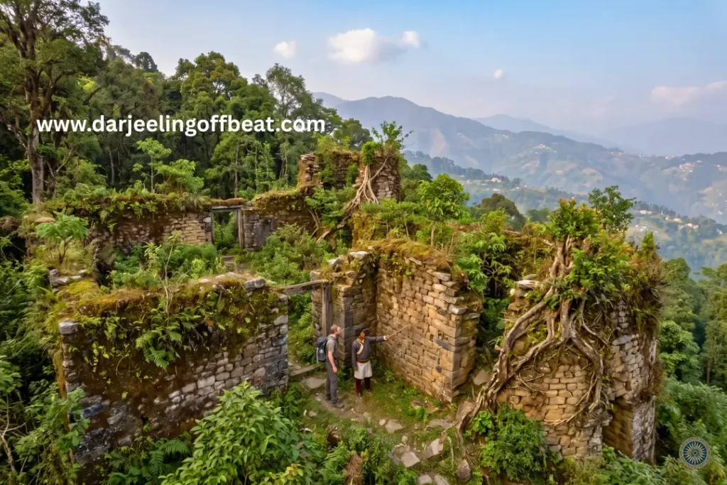
The Damsangdugi Fort (Damsang Fort) ruins near Pedong are the most tangible historical landmark of this heritage — a defensive structure approximately 300 years old, built during the period of conflict between the Lepcha and Bhutia kingdoms that shaped the political geography of the Eastern Himalayas before the British administrative period.
Walking among ruins of this age in a landscape this ecologically intact is an experience with a layered quality — the historical and the natural occupying the same physical space without either diminishing the other.
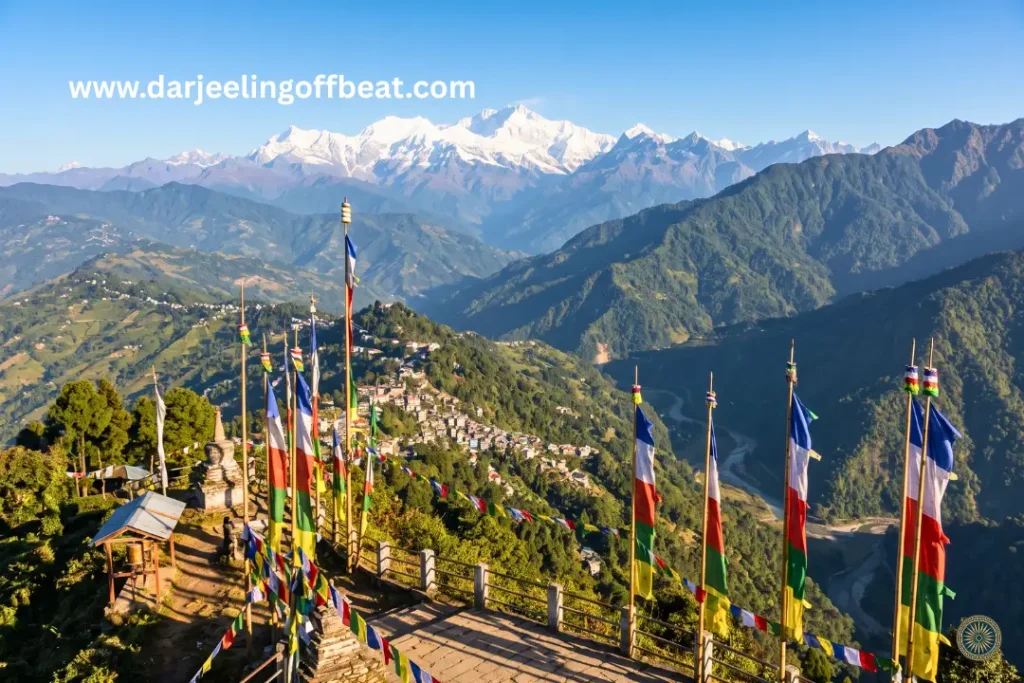
Tinchuley Viewpoint near Pedong provides the expansive panoramic complement to the forest immersion of Goiri Gaon: views of Mount Kanchenjunga, the Sikkim mountains, the Bhutanese ridges, and the Darjeeling hills from a single elevated position.
The Neora Valley Ecological Context
The conservation value of Neora Valley National Park — the 88-square-kilometre protected area that Goiri Gaon sits adjacent to — has been established throughout this site’s coverage, but its specific relevance to the Goiri Gaon experience is worth stating directly.
The national park’s forest canopy is not a distant backdrop to the village. It is the immediate environment — the dense subtropical trees, rhododendron groves, and bamboo thickets that begin at the village’s forest edge and extend through the national park to the transboundary corridor connecting Pangolakha Wildlife Sanctuary in Sikkim and Toorsa Strict Reserve in Bhutan. This connected wilderness — three protected areas across two national boundaries — is the ecological context within which Goiri Gaon exists.
The red panda (Ailurus fulgens) population that uses this corridor moves between the park interior and the village boundary zone, using the intact forest and the low light pollution of Goiri Gaon’s minimal development as the conditions that make the movement possible. Because the village maintains low built density and minimal night-time artificial lighting, wildlife movements across the park boundary occur with little habitat disturbance — the specific combination of conditions that allows the corridor to function as a corridor rather than fragmenting into isolated habitat patches.
For birdwatchers, the forest-edge habitat of Goiri Gaon, Kalimpong, Neora Valley — offbeat — where the national park forest meets the village agricultural margin — is consistently the most productive observation zone in any protected-area-adjacent landscape. The overlap of forest-interior and agricultural-margin species in the transitional zone creates a concentration of diversity that makes forest-edge birding the most rewarding approach in this ecosystem.
The Maria Busty Day-Trip Circuit — Beyond the Village
Goiri Gaon Kalimpong Neora Valley offbeat’s position within the Maria Busty regional network and its connections to the Western Dooars make it a natural anchor for a broader circuit that extends well beyond the village itself.
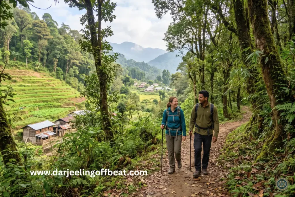
The Maria Busty circuit of neighbouring hamlets — Paren, Tumsung, Suruk, Godak, Chisung, Todey — forms the immediate village-level exploration territory. The walking trails connecting these settlements pass through the mid-altitude forest and agricultural landscape of the same ecological zone, each village offering a slightly different community character within the shared landscape.
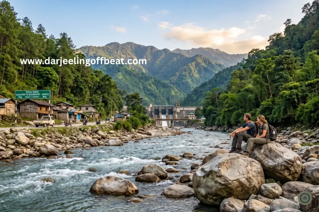
The Western Dooars extension — Jhalong, Bindu, and Murti — provides the river-valley and low-altitude counterpart to Goiri Gaon Kalimpong Neora Valley offbeat’s ridge experience. Jhalong on the Jaldhaka River, Bindu at the road’s end near the Bhutan border dam, and Murti on the Murti River each carry the specific riverine and forest character of the sub-Himalayan Dooars zone — a complete ecological contrast to the mid-altitude temperate character of Goiri Gaon itself. A circuit that combines the Neora Valley ridge with the Dooars river valleys covers the full landscape range of the north Kalimpong-Dooars corridor in a coherent multi-day itinerary.
Kalimpong town day excursions are equally accessible: Deolo Park for the managed hilltop viewpoint experience, Durpin Monastery for the Tibetan Buddhist cultural encounter, the Pine View Cactus Nursery for the botanical dimension, Mangal Dham Pranami Temple, and the Kalimpong Science Centre for the educational complement — all available as half-day additions before returning to the quiet environment of the village.
Getting to Goiri Gaon Kalimpong Neora Valley offbeat
The approach requires navigating narrow mountain roads from the primary transit centres, making reserved light motor vehicles or four-wheel-drive jeeps the only practical option.
From Siliguri: Approximately 100 kilometres — roughly 3 to 3.5 hours. The primary urban hub for North Bengal, well connected nationally.
From NJP (New Jalpaiguri): Around 95 to 105 kilometres — the primary railhead for the region.
From Bagdogra Airport: Approximately 100 kilometres.
From Kalimpong town: Roughly 35 to 45 kilometres via the Pedong road network — the most direct approach from the Kalimpong hills circuit.
From Pedong: 21 kilometres of Silk Route road, approaching from the historical trade corridor that gives the region its cultural depth.
The journey to Goiri Gaon Kalimpong Neora Valley offbeat involves exactly the kind of mountain road that rewards a driver who knows it — narrow, winding, with the forest pressing close on both sides as the elevation increases. For first-time visitors, confirming road conditions with your homestay host before departure is practical caution rather than excessive preparation.
Goiri Gaon Kalimpong Neora Valley offbeat: Seasonal Travel Guide
Understanding the seasonality of Goiri Gaon Kalimpong Neora Valley offbeat is essential — not just for comfort, but for safety on the mountain roads that provide the only access.
September to November — Post-Monsoon and Autumn (Highly Recommended)
Clear skies, stable ground conditions, and the exceptional atmospheric clarity that the post-monsoon season delivers across the Eastern Himalayas. Mountain visibility is at its annual peak. The forest is still richly green from monsoon rains. Wildlife activity in the Neora Valley buffer zone is at its most visible as the monsoon moisture has settled. The most consistently excellent season for nature walks, photography, and birdwatching.
December to February — Winter
Cool temperatures, dry atmosphere, and stable road access. The forest in winter has the specific character of reduced leaf density and improved wildlife sight lines. The Kanchenjunga views from the circuit viewpoints are at their sharpest in the cold dry air. A quiet season with minimal visitor traffic — the most complete version of the solitude that Goiri Gaon offers.
March to May — Spring and Pre-Monsoon (Highly Recommended)
Mild weather, blooming flora, and clear travel windows make this the spring season’s combination of botanical richness and landscape clarity. The rhododendron bloom on the Neora Valley slopes above the village. Bird migration through the corridor peaks in April. An excellent season for the full Maria Busty circuit and any trekking extensions into the national park.
June to August — Monsoon (Travel Discouraged)
Heavy rainfall, frequent landslides, and muddy road surfaces on the mountain feeder roads to Goiri Gaon. The slopes along unpaved roads destabilise during the monsoon, triggering slides that can isolate communities for periods. The forest is extraordinarily lush and alive — for niche monsoon travellers who understand the conditions and have flexible itineraries, the forest character in this season is extraordinary. For most visitors, the primary window is September through May.
Staying at Goiri Gaon — The Homestay Model in Practice
The community-based homestay system at Goiri Gaon Kalimpong Neora Valley offbeat operates on a model that is more specific than the general “family-run accommodation” description that appears throughout the offbeat travel circuit.
The homestays provide modern amenities — western-style flush toilets, running water, grid electricity, home-cooked meals — that distinguish them from the more basic rural accommodation that “offbeat” sometimes implies. The integration of visitors into traditional family compounds is the cultural mechanism rather than the level of facility. You are staying with a family in their home; the home is comfortable by reasonable standards.
The economic model is the specific conservation mechanism: by keeping accommodation exclusively within family-run homestays rather than permitting commercial hotel development, the village ensures that tourism revenue flows directly into agricultural households, that the physical scale of development remains proportional to the ecological carrying capacity of the ridge, and that the light, noise, and waste pollution of commercial hotel operations never arrives to compromise the specific acoustic and ecological quality that makes Goiri Gaon worth visiting.
Meals draw from the local agricultural production — the terrace-farmed vegetables, the seasonal crops of the mid-altitude zone, and the culinary tradition of the Kalimpong hills community. The food is the farm-to-table connection in its most literal and honest form.
Sustainable Infrastructure — What Goiri Gaon Kalimpong Neora Valley offbeat Has Chosen
The community’s commitment to ecological stewardship extends beyond the accommodation model into specific infrastructure decisions that reflect an understanding of what unregulated development does to places like this.
Low built density — the absence of large resort complexes preserves the wildlife movement corridors that the national park border location creates. Red pandas and other park species that move across the boundary do so because the village has not built the barriers that development creates.
Minimal night-time artificial lighting — the specific condition that allows wildlife movement across the park boundary with minimal habitat disturbance. Light pollution, which affects wildlife behaviour across a radius far larger than the illuminated area, is controlled by the village’s low development model.
Homestay capacity management — the self-limiting nature of family-run accommodation means that visitor numbers are naturally capped by available family rooms rather than by an imposed regulatory limit. The carrying capacity limit is structural rather than administrative.
Future planning requirements for the village include road durability improvements against seasonal rains, community waste management systems, and small-scale guided nature walk infrastructure. The path forward maintains the model that has worked — low capacity, high ecological integrity, direct community benefit — while addressing the specific infrastructure gaps that currently limit the experience.
Things to Do at Goiri Gaon
Forest edge birdwatching at the Neora Valley boundary — the park-adjacent forest edge in the early morning hours, guided by a local community member with knowledge of the specific regular activity zones. The most productive wildlife observation time is the two hours after dawn.
Maria Busty Parish and Vijaya Rani Girja visit — the 1891 church, the historical Grotto, and the medicinal plant and bonsai garden. A cultural encounter with the missionary heritage of the Kalimpong hills that most visitors never find.
Pedong Silk Route circuit — the Damsangdugi Fort ruins (300 years old), the Pedong monastery, and the historical Silk Route road that connected Bengal to Tibet via Jelep La. The cultural and historical depth of the corridor that Goiri Gaon sits within.
Tinchuley Viewpoint — the Kanchenjunga, Sikkim, Bhutan, and Darjeeling hills panorama from the elevated ridge position near Pedong.
Maria Busty circuit walking trails — the connecting paths between Goiri Gaon and the neighbouring hamlets of Soureni, Benda, Gerok, Chansing, Lingsey, Duka, and Ladam. The village-to-village walking network through mid-altitude forest and agricultural landscape.
Western Dooars day trip — the descent from Goiri Gaon’s ridge to the Dooars river valleys at Jhalong, Bindu, and Murti, covering the complete ecological transition from mid-altitude temperate forest to sub-Himalayan subtropical riverine landscape.
Kalimpong town half-day — Deolo Park, Durpin Monastery, Pine View Nursery, Mangal Dham Temple, and the urban complement to the village quiet.
Red panda habitat walk — the forest sections with local guide knowledge of the specific bamboo grove areas most productive for red panda sightings. October to February, when the animals move to lower elevations.
Why Goiri Gaon — The Specific Case for This Village
The Lava-Lolaygaon-Neora Valley circuit is well established among informed offbeat travellers in West Bengal. Goiri Gaon sits adjacent to that circuit — connected to it ecologically through the national park, connected logistically through the Kalimpong hills road network — but has not yet been absorbed into the mainstream offbeat itinerary.
The Maria Busty Parish adds the specific cultural dimension that purely natural sites lack. The Pedong Silk Route heritage adds historical depth. The Dooars circuit connection adds the low-altitude ecological contrast. The wildlife corridor function provides the conservation significance.
And the community’s specific decisions — no commercial development, homestay-only model, minimal lighting, capacity management — provide the guarantee that the visit’s quality is maintained rather than degraded by the success of the destination.
The window for visiting a place like this before it becomes widely known is always narrower than it looks. The forest edge walk to the park boundary in the morning. The 1891 church in the medicinal plant garden. The red panda that uses the corridor because the village has kept it intact. These are available now, in this specific combination, at this specific quality.
Come quietly. Leave it as you found it
Location: Samthar Gram Panchayat, Kalimpong District, West Bengal
Regional network: Maria Busty Sub-Centre (with Soureni, Benda, Gerok, Chansing, Lingsey, Duka, Ladam)
Park adjacency: Western periphery of Neora Valley National Park (88 sq km, est. 1986)
From Siliguri: ~100 km | From NJP: ~95–105 km | From Kalimpong: ~35–45 km
Accommodation: Homestay-only model (no commercial hotels)
Heritage sites: Maria Busty Parish/Vijaya Rani Girja (1891), Damsangdugi Fort (300 yrs), Pedong Silk Route
Circuit: Maria Busty hamlets, Pedong, Tinchuley, Jhalong/Bindu/Murti (Dooars), Kalimpong town
Key wildlife: Red Panda corridor, Eastern Himalayan birds
Best seasons: September–November and March–May
Travel caution: Monsoon (June–August) — road hazard, travel discouraged
Don’t miss: Forest edge morning birdwatching, Maria Busty Parish, Pedong Fort ruins, red panda habitat walk, Dooars day circuit
Gitkolbong Village Kalimpong: The Village That Climbs From River to Ridge
Daragaon Kalimpong Kanchenjunga View Where the Clouds Stay Below You
Q.1: Where exactly is Goiri Gaon located?
Ans: Goiri Gaon is in the Samthar Gram Panchayat of Kalimpong district, West Bengal, directly on the western edge of Neora Valley National Park. It is approximately 100 km from Siliguri and 35–45 km from Kalimpong town.
Q.2: Is there any hotel accommodation in Goiri Gaon?
Ans: No. Goiri Gaon has no commercial hotels — only community-managed family homestays. This is a deliberate community decision to protect the village’s ecological character and keep tourism revenue within local households.
Q.3: What is the best time to visit Goiri Gaon?
Ans: September to November (post-monsoon clarity) and March to May (spring bloom and bird migration) are the best windows. June to August monsoon season is actively discouraged — mountain roads become dangerous from landslides.
Q.4: Can you see Red Pandas at Goiri Gaon?
Ans: Yes, it is possible. Goiri Gaon functions as a buffer zone for the Neora Valley National Park corridor, and Red Pandas move through the forest edge. From October to February, early-morning guided walks offer the best chance of a sighting.
Q.5: What is the Maria Busty Parish?
Ans: The Maria Busty Parish is a historic Catholic site founded in 1891 by French missionary Rev. Fr. M. Hervagault. It includes the Vijaya Rani Girja church, a historical Grotto, and a garden of Himalayan medicinal plants and bonsai maintained by local educators.
Q.6: What are the best day trips from Goiri Gaon?
Ans: The Damsangdugi Fort ruins near Pedong (300 years old), Tinchuley Viewpoint for the Kanchenjunga panorama, the Jhalong-Bindu-Murti Dooars river circuit, and Kalimpong town’s monasteries and nurseries — all accessible as day excursions.
Q.7: Is Goiri Gaon good for birdwatching?
Ans: Absolutely. Its direct adjacency to Neora Valley National Park makes the forest edge one of the most productive birdwatching zones in the Kalimpong hills — Blood Pheasant, Himalayan Monal, Fire-tailed Sunbird, and Red Panda corridor species are all documented here
Q.8: How far is Goiri Gaon from NJP railway station?
Ans: Approximately 95 to 105 kilometres from New Jalpaiguri (NJP) Junction — roughly 3 to 3.5 hours by road. Bagdogra Airport is around the same distance at approximately 100 kilometres.
Q.9: Can Goiri Gaon be used as a base for Neora Valley trekking?
Ans: Yes. Guided treks from Goiri Gaon into Neora Valley National Park are possible, with routes leading to Rechela Top at 10,600 feet — the tri-junction of West Bengal, Sikkim, and Bhutan.
Q.10: Is mobile connectivity available at Goiri Gaon?
Ans: Limited. Airtel and Jio networks function partially. The low development model of the village means connectivity is intentionally minimal — treat it as a digital detox feature rather than an inconvenience.
- Kashyem Kaman Kalimpong Teesta Rangpo Confluence View 2026: The Cedar Ridge
 Kashyem Kaman Kalimpong Teesta Rangpo confluence view — Teesta-Rangpo confluence below and Kanchenjunga above — plus Cinchona heritage trails and cedar forest homestays at ₹1,250/day. There is a specific kind of view that requires exactly the right elevation — too high and the cloud covers everything, too low and the angle is wrong. Kashyem Kaman …
 - Kalijhora Homestay & Teesta Travel Guide: How a Picnic Spot Turned Into North Bengal’s Quietest Adventure HubKalijhora homestay guide: where to stay near the Teesta, rafting routes & prices, Panboo ridge views, and everything to plan your North Bengal trip If you’ve driven up NH10 from Siliguri toward Kalimpong or Darjeeling, you’ve passed through Kalijhora without necessarily noticing it. That’s kind of the point. It sits about 28 kilometres north of …
- Goiri Gaon, Kalimpong: The Village the Forest Kept Secret — Now With the Full StoryGoiri Gaon Kalimpong Neora Valley offbeat — red panda corridor, Maria Busty 1891 church, Pedong Silk Route ruins, and homestay-only model. Complete offbeat guide inside. There are places in the Eastern Himalayas that exist in a kind of geographical grace — tucked far enough from the main roads that the noise of modern hill tourism …
- Gitkolbong Village Kalimpong: The Village That Climbs From River to RidgeGitkolbong village Kalimpong near Lava, with tea plantations, the Gitkhola river, and a ridge trail to Gitkolbong Top with Kanchenjunga views. Complete offbeat travel guide inside. Some places reveal themselves slowly. You arrive, and the first impression is modest — a quiet mountain village, some terraced farmland, a stream you can hear before you see …
- Daragaon Kalimpong Kanchenjunga View Where the Clouds Stay Below YouDaragaon Kalimpong Kanchenjunga view— offers a rare sea-of-clouds sunrise view with the world’s third-highest peak floating above the Teesta valley. Complete travel guide inside. There’s a moment that happens at Daragaon — usually around six in the morning, usually in October or November — that people struggle to describe accurately afterwards. You’re standing at the …
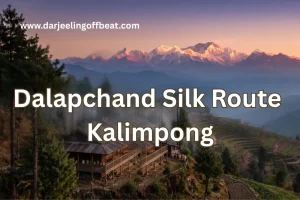
- Dalapchand Silk Route Kalimpong: Where West Bengal Meets SikkimSome destinations, like Dalapchand Silk Route Kalimpong, exist because someone put them on a map, and others exist because the landscape demanded them. Dalapchand is the second kind. Sitting right on the border zone between Kalimpong district in West Bengal and Pakyong district in East Sikkim, this quiet mountain hamlet occupies a genuinely rare position. …







North Bengal's offbeat magic is my muse. I find adventure in whispering waterfalls, vibrant village life, and breathtaking Himalayan vistas. Join me as I delve deeper, seeking stories and experiences beyond the mainstream, from Darjeeling's tea havens to the unexplored corners of this incredible region