
Darjeeling is a hill town in Northern India in the state of West Bengal. People often ask Where is Darjeeling located on India map
Because Darjeeling’s location is not simply a set of coordinates. It is a geopolitical pivot point — a place where India touches Nepal to the west, Bhutan to the east, Sikkim to the north, and Bangladesh to the south, with Tibet sitting quietly behind the Himalayan crest above all of it. Five sovereign entities visible from a single elevated ridge. That is the real answer to where Darjeeling is located.
The Exact Coordinates: Where is Darjeeling Located on the India Map
Darjeeling municipal core sits at 27°02’15″N to 27°03’00″N latitude and 88°15’47″E to 88°16’00″E longitude, at a mean elevation of 2,042 to 2,134 metres (6,700 to 7,001 feet) above sea level. This places the hill station in the northernmost salient of West Bengal, embedded within the Lesser and Outer Himalayan ranges of the Eastern Himalayas.
The broader Darjeeling district — which extends well beyond the municipal hill station — occupies the territory between 26°31’N and 27°13’N latitude and 87°59’E and 88°53’E longitude. Across this administrative expanse, the physical terrain spans an extraordinary altitudinal range: from the low-lying alluvial Terai plains at approximately 100 metres (300 feet) in the south to the sub-alpine ridgelines of the Singalila Ridge reaching 3,600 metres (11,800 feet) in the north. The district covers approximately 3,149 square kilometres.
This altitudinal compression — from near-plains level to sub-alpine ridge within a single district — is one of the most dramatic ecological gradients in South Asia, and it is the foundation of everything that makes Darjeeling remarkable.

The Five Neighbours — Darjeeling’s Geopolitical Landscape
Darjeeling’s location is most precisely understood through its borders, because very few places on Earth have this specific combination of international and interstate boundaries converging in such proximity.
To the North — Sikkim (and beyond it, Tibet)
The northern boundary with the Indian state of Sikkim is defined by three distinct river systems: the Ramman River, the Great Rangit River, and segments of the Teesta River. Beyond Sikkim’s northern boundary lies the Tibet Autonomous Region of China. The snow peaks that Darjeeling is famous for viewing — Kanchenjunga, Kabru, Rathong — stand in this northern direction.
To the West — Nepal
The western boundary with Nepal’s Koshi Province follows the Singalila mountain crest and the southerly flowing Mechi River. The Singalila Ridge that forms this Indo-Nepal boundary is the same ridge that the famous Sandakphu-Phalut trekking circuit follows — the high alpine trail where on clear days both Everest and Kanchenjunga are visible simultaneously from a single walk. The Indo-Nepal border at Simana Dara, on the Darjeeling-Mirik highway, is the specific point where this boundary is accessible to visitors as a landscape experience.
To the East and Northeast — Kalimpong District, Jalpaiguri District, and Bhutan
The eastern boundary is defined by the Teesta River gorge separating Darjeeling from Kalimpong district. Further northeast, the boundary continues toward the international frontier with the Kingdom of Bhutan near the Jaldhaka River and the Rishi La massif. The deep Teesta gorge that separates Darjeeling from Kalimpong is one of the most significant river boundaries in this region — the same river that originates far to the north in Sikkim and runs through the NH10 corridor below.
To the South and Southeast — The Plains
The district’s southern edge borders the northern alluvial plains of Uttar Dinajpur district in West Bengal and Panchagarh district of Bangladesh. The southwestern edge touches Kishanganj district in Bihar. This southern fringe encompasses the Siliguri Corridor — the narrow but strategically critical bottleneck that connects mainland India with all its northeastern states. Without the Siliguri Corridor, the geography of northeastern India would be fundamentally different.

The Y-Shaped Ridge — Understanding Where is Darjeeling Located on the India Map
Darjeeling town is not built on a mountain. It is built on a ridge — and specifically on an elevated Y-shaped mountain ridge within what geologists call the Darjeeling-Jalapahar formation.
The structural base of this Y-shaped ridge anchors to the south at Ghum at approximately 2,258 metres — the highest point on the ridge system and the location of the famous Ghum Monastery and the Batasia Loop of the Darjeeling Himalayan Railway. The ridge then ascends northward through the high spurs of Katapahar and Jalapahar.
North of Observatory Hill — the sacred hill at the centre of the town, topped with Buddhist and Hindu shrines — the ridge splits into two divergent branches. The north-eastern arm descends sharply to terminate at the Lebong spur, where the Lebong Race Course (one of the smallest and most spectacularly situated race courses in the world) is located. The north-western arm extends through North Point and descends toward the valley floors near the Tukver and Happy Valley tea estates.
This Y-shaped ridge geometry explains why Darjeeling‘s urban street network is so irregular — the town follows the ridge, and the ridge does what ridges do. It is not a flat hilltop settlement but a three-dimensional urban form distributed across an elevated branching mountain structure.
What Darjeeling Can See — The View from 6,700 Feet
The ridge position and high relief of Darjeeling provide an unobstructed viewshed across the surrounding valley systems toward the Greater Himalayan crest.
Mount Kanchenjunga (8,591 metres) — the third-highest mountain on Earth — rises prominently on the northern skyline at a direct distance of roughly 75 kilometres. The mountain is visible from multiple points across Darjeeling town, but the most celebrated view is from Tiger Hill, which at 2,590 metres provides the elevated sightline that makes the Kanchenjunga profile at sunrise one of the most photographed mountain views in India.
Mount Everest (8,848 metres) remains visible from the high ridge crests of the Singalila Range — specifically from Sandakphu at 3,636 metres on the Indo-Nepal border ridge — during dry, post-monsoon atmospheric conditions. Everest is not visible from the town itself but from the high-altitude trekking circuit that the Darjeeling district contains.
The deep fluvial trenches — the Teesta gorge to the east, the Rangit valley to the north — are visible from appropriate vantage points in the town, giving Darjeeling‘s landscape an extraordinary vertical complexity. You can look down into gorges thousands of feet deep from streets that carry ordinary urban traffic.
The River Systems That Define the District
The Darjeeling district is hydrologically organised around several major river systems, each draining different sectors of the hill terrain.
The Teesta River is the principal hydrographic artery — carving its enormous north-to-south canyon that physically isolates the Darjeeling ridge from Kalimpong before breaking through the Siwaliks at Sevoke to reach the plains. The Teesta is visible from many Darjeeling district vantage points as the defining landscape feature of the eastern valleys.
The Great Rangit River forms the primary right-bank affluent to the Teesta, draining the northern sector of the district through lateral tributaries including the Little Rangit, Ramman, and Rangnu rivers. The Teesta-Rangit confluence at Triveni — visible from viewpoints like Lover’s Meet on the Peshok Road — is one of the most geographically significant river junctions in the region.
The Mahananda River drains southward from the Kurseong hills into the Terai, passing through the Siliguri basin.
The Balason River descends southward from the Lepchajagat-Sukhiapokhri ridge through the western hill tracts, reaching the foothill deceleration zone at Dudhia on the Mirik highway — the same gravel-bed landscape we describe in the Dudhia guide on this site.
The Mechi River flows southward along the western frontier, serving as the natural border between India and Nepal.
The Geology Beneath the Landscape
Darjeeling sits on one of the most tectonically active terrains in South Asia. The collision of the Indo-Australian and Eurasian plates — an ongoing process that has been running for over 50 million years — places the entire region in Seismic Zone-IV under Bureau of Indian Standards classification, indicating high susceptibility to seismic activity.
The rock sequence visible across the Darjeeling hills reflects the thrust tectonics that built this landscape. At the southernmost fringe lies the Siwalik System — Tertiary sandstones, conglomerates, and shales. Moving northward, the Siwaliks are overridden by the Damuda Series — quartzites, hard sandstones, and slates. At higher structural elevations, the Daling Series of phyllites and slates transitions upward into the heavily foliated Darjeeling Gneiss — the ancient, high-grade metamorphic rock sequence that underlies the highest terrain.
This geological complexity has a practical consequence: the monsoon rainfall that the southern windward slopes receive — between 4,000 and 5,000 millimetres annually — interacts with the fractured metamorphic rock and steep joint systems to produce widespread landslides, debris flows, and slope failures that persistently challenge Darjeeling’s infrastructure. The scenic landscape and the infrastructural vulnerability share the same geological origin.
The Historical Geography — How These Borders Were Made
The contemporary boundaries of Darjeeling are not natural — they are the product of nineteenth-century imperial negotiations involving multiple kingdoms and a colonial power, and understanding them helps understand why the region has the specific geopolitical character it does.
Before the early nineteenth century, the Darjeeling ridge was controlled by the Chogyal of Sikkim, though it was occupied by Gorkha forces from Nepal between 1780 and 1814. The Anglo-Nepalese War ended this Gorkha occupation, and the subsequent Treaties of Sugauli (1815) and Titalia (1817) ceded Nepal’s annexed lands between the Mechi and Teesta rivers back to Sikkim.
Then in 1835, Company officials negotiated a deed of grant from the Chogyal of Sikkim for an enclave of roughly 138 square miles — the Darjeeling ridge — to establish a high-altitude military sanatorium and observation outpost. This was the founding act that created Darjeeling as a British administrative entity.
Jurisdictional disputes led to the annexation of surrounding hill tracts and the Terai in 1849. The formal annexation of territory east of the Teesta River following the Anglo-Bhutan War of 1865 finalised the district boundaries by 1866 — the same war that transferred the Kalimpong hills from Bhutanese to British administration and whose consequences are still visible in the landscape of Bhutan-border villages like Chisang and Keramtar in Kalimpong district.
Following Indian independence in 1947, Darjeeling was integrated into West Bengal. Today, the hill subdivisions — Darjeeling Sadar, Kurseong, and Mirik — are governed under the semi-autonomous Gorkhaland Territorial Administration (GTA), maintaining the distinct regional identity of the Darjeeling hills within the Indian federal structure.
Key Distances from Darjeeling
| Destination | Distance | Notes |
|---|---|---|
| Siliguri | ~80 km | Via Hill Cart Road or NH10 |
| New Jalpaiguri (NJP) | ~88 km | Primary railhead |
| Bagdogra Airport | ~90 km | Primary air entry point |
| Kolkata | ~600 km | By road; ~8 hours by train |
| Kalimpong | ~50 km | Via Teesta Bazaar |
| Mirik | ~52 km | Via Peshok Road |
| Gangtok (Sikkim) | ~100 km | Via Sevoke-Rangpo |
| Kanchenjunga | ~75 km | Direct line of sight |
| Nepal border (Mirik side) | ~20 km | Simana Dara viewpoint |
Getting to Darjeeling — The Practical Logistics
By Air: Bagdogra Airport (IXB) is the nearest airport, approximately 90 kilometres from Darjeeling town. Connected to major Indian cities including Kolkata, Delhi, Mumbai, and Bengaluru. From Bagdogra, taxis and shared jeeps ascend to Darjeeling via the NH10 (Sevoke Road) or the Hill Cart Road.
By Rail: New Jalpaiguri (NJP) Junction, approximately 88 kilometres away, is the primary railhead — well connected by train to Kolkata and major cities. The famous Darjeeling Himalayan Railway (the Toy Train, a UNESCO World Heritage property) runs between New Jalpaiguri and Darjeeling, though it operates primarily as a heritage and tourism service rather than a practical commuter route. The diesel service runs a full route; the steam service operates shorter heritage segments.
By Road: NH10 via Siliguri and the Sevoke Coronation Bridge is the primary highway approach. The Hill Cart Road is the original route, steeper and more scenic. The journey from Siliguri takes approximately 3 to 4 hours by road.
The Name — What Darjeeling Actually Means
The name Darjeeling derives from the Tibetan-Nepali compound: Dorje (meaning thunderbolt — the ritual sceptre of Indra in Buddhist iconography) and Ling (meaning place or land). Darjeeling is therefore the Land of the Thunderbolt — a name that predates the British administrative establishment and reflects the indigenous understanding of this landscape as a spiritually significant elevation.
The British commonly spelt the name as Darjeeling, though earlier colonial records use Darjeeling, Darjiling, and Dárjíling interchangeably. The local Nepali and Gorkha community has historically pronounced it closer to the original Dorjeeling — the thunderbolt land.
What Darjeeling Is Famous For
Tea: Darjeeling Orthodox tea with Geographical Indication status — the muscatel character second flush and the delicate first flush spring harvest from the district’s 87 tea estates are among the most traded and valued single-origin teas in the world.
The Toy Train: The Darjeeling Himalayan Railway, a narrow-gauge 2-foot railway built between 1879 and 1881, winding up the hillside from New Jalpaiguri through Kurseong and Ghum to Darjeeling. A UNESCO World Heritage property since 1999.
Tiger Hill: The pre-dawn viewing point at 2,590 metres from which Kanchenjunga and, on exceptionally clear days, Everest appear in the sunrise light. One of the most iconic sunrise viewpoints in India.
Colonial Heritage: The residential schools, colonial bungalows, churches, and institutional architecture of British India’s premier hill station — including St. Paul’s School, the Planters’ Club, and the magnificent natural history collection of the Padmaja Naidu Himalayan Zoological Park.
Trekking: The Singalila Ridge circuit — Sandakphu (highest point in West Bengal at 3,636 metres) and Phalut — providing the dual Everest-Kanchenjunga view that is the most celebrated high-altitude trekking experience in eastern India.
Source: Wikipedia
In the above blog post we covered Where is Darjeeling located, Darjeeling location India map, Darjeeling coordinates latitude longitude, Darjeeling which state India, Darjeeling West Bengal location, Darjeeling elevation altitude, Darjeeling bordering countries, Darjeeling Nepal Bhutan Sikkim border, Darjeeling district area, Darjeeling nearest airport railway, Darjeeling Himalayan geography,
Darjeeling geopolitical location, Darjeeling hill station location, Darjeeling Teesta river location, Where is Darjeeling in West Bengal, Darjeeling distance from Kolkata, Darjeeling distance from Siliguri, Darjeeling GTA administration, Darjeeling Singalila Ridge location, Darjeeling thunderbolt meaning name all the tops. Thanks for reading
🅵🅰🆀
Q.1: Where is Darjeeling located in which state?
Ans: Darjeeling is located in West Bengal, the easternmost state of mainland India. It is approximately 490 kilometres north of the state capital Kolkata, at an elevation of approximately 2,134 metres (7,000 feet) above sea level.
Q.2: Where is Darjeeling located in India map and which state?
Ans: Darjeeling famous hill station in Eastern Himalayas located in West Bengal
Q.3: What is Darjeeling famous for?
Ans: Darjeeling is famous for its scenic beauty as well as Darjeeling Tea
Q.4: What is the real name of Darjeeling?
Ans: ‘Darjeeling’ word is made from two words ‘dorje’ means thunderbolt (originally the scepter of Indra) and ‘ling’ means ‘a place or land’.So Darjeeling is called ‘The Land of the Thunderbolt’
Q.5: How to travel to Darjeeling?
Ans: The nearest airport is Bagdogra and the nearest rail station is New Jalpaiguri or Siliguri
Q.6: What countries border Darjeeling district?
Ans: The Darjeeling district borders Nepal to the west (along the Singalila Ridge and Mechi River), Bhutan to the northeast (near the Jaldhaka River), and the district is separated from Tibet (China) only by the state of Sikkim to the north. Bangladesh borders the district’s southernmost plains extension.
Q.7: What is Darjeeling’s altitude?
Ans: The municipal core of Darjeeling town sits between 2,042 and 2,134 metres (6,700 to 7,001 feet) above mean sea level. The broader district ranges from approximately 100 metres in the Terai plains to 3,636 metres at Sandakphu on the Singalila Ridge.
Q.8: Can you see Mount Everest from Darjeeling?
Ans: Not from Darjeeling town itself, but from Tiger Hill (2,590 metres) on very clear post-monsoon mornings, Everest is visible on the western horizon at a distance of approximately 225 kilometres. From Sandakphu (3,636 metres) on the Singalila Ridge, Everest is clearly visible alongside Kanchenjunga.
Q.9: How far is Darjeeling from Sikkim?
Ans: Darjeeling town is approximately 100 kilometres from Gangtok, the Sikkim state capital. The Darjeeling-Sikkim administrative boundary follows the Ramman River, the Great Rangit River, and segments of the Teesta River.
Q.10: Is Darjeeling safe to visit?
Ans: Darjeeling is generally safe for tourists throughout the year. The primary seasonal consideration is the monsoon (June to September), when heavy rainfall can cause landslides on the hill roads. October through May is the most comfortable and reliable travel period.
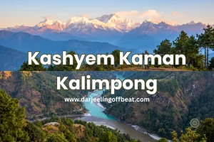
- Kashyem Kaman Kalimpong Teesta Rangpo Confluence View 2026: The Cedar Ridge
 Kashyem Kaman Kalimpong Teesta Rangpo confluence view — Teesta-Rangpo confluence below and Kanchenjunga above — plus Cinchona heritage trails and cedar forest homestays at ₹1,250/day. There is a specific kind of view that requires exactly the right elevation — too high and the cloud covers everything, too low and the angle is wrong. Kashyem Kaman …
 - Kalijhora Homestay & Teesta Travel Guide: How a Picnic Spot Turned Into North Bengal’s Quietest Adventure HubKalijhora homestay guide: where to stay near the Teesta, rafting routes & prices, Panboo ridge views, and everything to plan your North Bengal trip If you’ve driven up NH10 from Siliguri toward Kalimpong or Darjeeling, you’ve passed through Kalijhora without necessarily noticing it. That’s kind of the point. It sits about 28 kilometres north of …
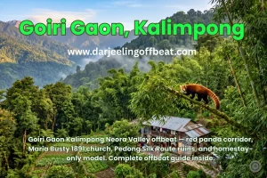
- Goiri Gaon, Kalimpong: The Village the Forest Kept Secret — Now With the Full StoryGoiri Gaon Kalimpong Neora Valley offbeat — red panda corridor, Maria Busty 1891 church, Pedong Silk Route ruins, and homestay-only model. Complete offbeat guide inside. There are places in the Eastern Himalayas that exist in a kind of geographical grace — tucked far enough from the main roads that the noise of modern hill tourism …
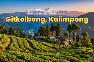
- Gitkolbong Village Kalimpong: The Village That Climbs From River to RidgeGitkolbong village Kalimpong near Lava, with tea plantations, the Gitkhola river, and a ridge trail to Gitkolbong Top with Kanchenjunga views. Complete offbeat travel guide inside. Some places reveal themselves slowly. You arrive, and the first impression is modest — a quiet mountain village, some terraced farmland, a stream you can hear before you see …
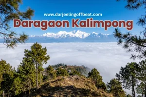
- Daragaon Kalimpong Kanchenjunga View Where the Clouds Stay Below YouDaragaon Kalimpong Kanchenjunga view— offers a rare sea-of-clouds sunrise view with the world’s third-highest peak floating above the Teesta valley. Complete travel guide inside. There’s a moment that happens at Daragaon — usually around six in the morning, usually in October or November — that people struggle to describe accurately afterwards. You’re standing at the …
- Dalapchand Silk Route Kalimpong: Where West Bengal Meets SikkimSome destinations, like Dalapchand Silk Route Kalimpong, exist because someone put them on a map, and others exist because the landscape demanded them. Dalapchand is the second kind. Sitting right on the border zone between Kalimpong district in West Bengal and Pakyong district in East Sikkim, this quiet mountain hamlet occupies a genuinely rare position. …
- Chuikhim birding Kalimpong: That Sits Between Two WorldsThere’s a particular kind of traveller who plans a trip around a bird. Who wakes before the alarm, walks quietly into the forest before dawn, and stands absolutely still for twenty minutes because something small and extraordinary might appear in the canopy above. If you know this feeling — or suspect you might — then …
- Chisang Village Kalimpong: Where India Ends and Bhutan BeginsThere’s something quietly extraordinary about standing at the edge of a country and not at an airport or a formal border crossing, but on a hillside at dusk, looking across a valley into another nation’s lights. No fence in sight, no checkpoint, just a ridge and a silence and the slow understanding that the world …
- Bidyang Village, Kalimpong: A Riverside Escape You Didn’t Know You NeededSome places earn their reputation through grandeur — towering peaks, famous monasteries, names that appear on every travel list. And then there are places like Bidyang Kalimpong, which earn theirs more quietly. The sound of a river running over stones. The smell of cardamom on a warm afternoon. A valley so tucked away from the …




North Bengal's offbeat magic is my muse. I find adventure in whispering waterfalls, vibrant village life, and breathtaking Himalayan vistas. Join me as I delve deeper, seeking stories and experiences beyond the mainstream, from Darjeeling's tea havens to the unexplored corners of this incredible region